

It’s a shame that the bike trail from Schliersee to Bayrischzell isn’t a loop trail. Despite the impressive alpine scenery, there are only around 200 meters elevation to overcome on this easy bike trail south of Munich. Check out some famous sights in the region along the way.
Details
Easy
36 km
3 hours
220m elevation
Directions and Parking
The bike trail starts at Schliersee train station, serviced by the Bayerische Regiobahn (BRB) train to and from Munich. Ample parking is available at the station.
Bike Trail Description
Schliersee to Aurach: 10 km
The easy bike tour starts at Schliersee train station. From there you cycle in a westerly direction, cross the Schlierach and after a few hundred meters you come to the Westerbergstraße, which runs along the west bank of the Schliersee to Fischhausen-Neuhaus. The paved route is in great condition and is used by cyclists and pedestrians alike. The Rixneralm is located along this stretch of the path and is a great stop for refreshments before or after the bike tour.
Continue south past some of the most popular sights in the Schliersee region: the Markus Wasmeier open-air museum and the Josefsthal waterfalls. The 10-minute detour to the waterfalls is a must. The last few meters have to be covered on foot, you can leave you bike here for a few minutes quite safely at any time of day.
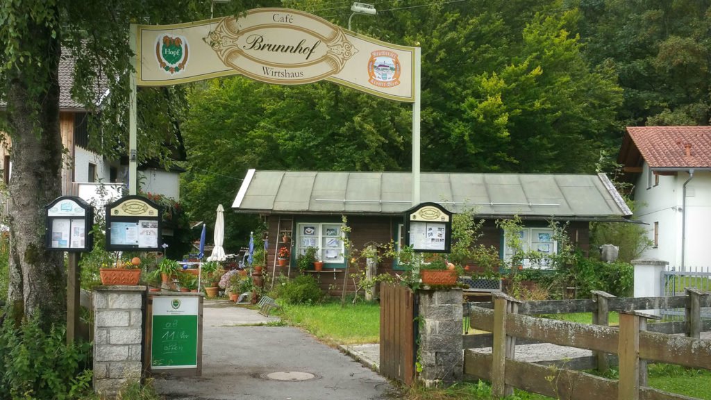
Continuing on you’ll pass Café Brunnhof with excellent cakes and a shady terrace, located directly on the cycle path.
Back on the road, it’s only another 5 kilometers to Aurach.
Aurach to Bayrischzell: 8 km
From Aurach, the cycle path runs alongside some of the highest mountains in the Mangfall region. No need to worry though: there is virtually zero incline on this trail, the path runs through the valley and is sutable for families and non-experienced bikers alike.

At 1884 m, the Rotwand to the south of the bike path is the highest peak in the district of Miesbach and the highest in the Bavarian part of the Mangfall Mountains. The Café Krugalm (with freshly baked cakes and home-style cooking) is the next refreshment stop along the cycle path. Shortly after you’ll pass the Wendelstein on the left, one of the most famous mountains in the region and, thanks to the Wendelstein cable car, one of the most popular sights for visitors to Schliersee.
The way back is identical to the way there. Alternatively, you can jump on the Bayerische Regiobahn (BRB) train in Bayrischzell back to Schliersee and on towards Munich.
Maps
Refreshments
Cafe Krugalm
Krugalmweg 1
83730 Fischbachau
Rixneralm
Westerbergstraße 40
83727 Schliersee
Café Wirtshaus Brunnhof
Aurachstr. 1
83727 Schliersee