
Despite a hiking time of around 6 hours and an ascent of 800 meters, the hike to the Rotwand (1884 m) is accessible even for occasional hikers. The view from the highest peak of the Bavarian Mangfall Mountains is magnificent and the hiking trail is easy to walk. Just before the summit, the Rotwand House awaits with food and cool drinks.
Details & Directions
| Start: | Spitzingsee Church |
| Difficulty: | Medium |
| Distance: | 12 km |
| Duration: | 6 h |
| Altitude: | 800 hm |
| Buggy-friendly: | No |
| By Bus & Train: | BRB to Schliersee and further with RVO Bus 9562 to Spitzingsee Church station |
| By Car: | Spitzingsee Church |
[the_ad id=”7225″]
Rotwand Ascent
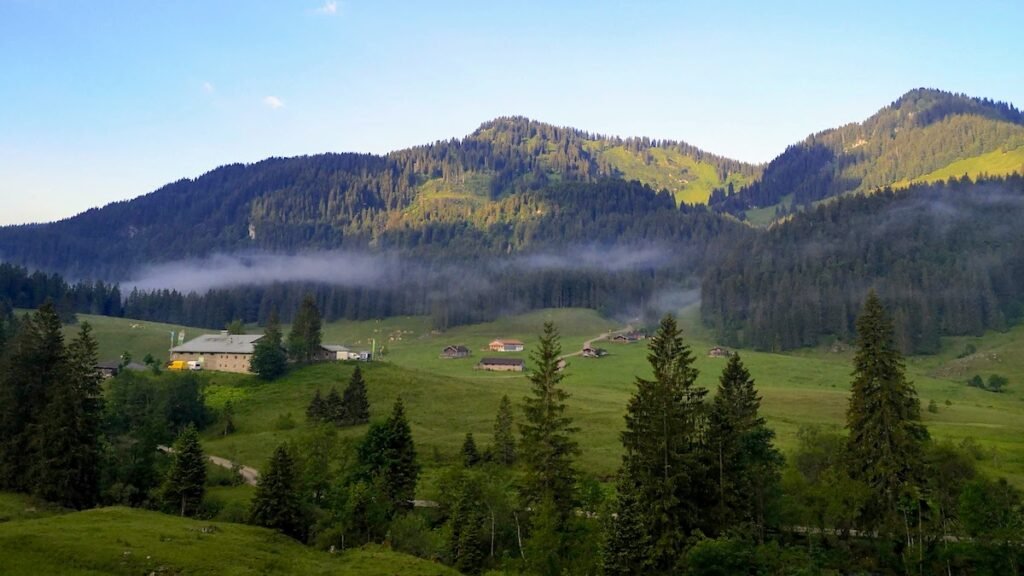
The hike here in the bavarian part of the Mangfall mountain range starts on the southern shore of Spitzingsee. Pass by the barrier adjacent to the Alten Wurzhütte and head south towards Albert-Link-Hütte.
Shortly after the barrier, the hiking trail branches off to the left and into the forest up to the Rotwand. After a clearing you’ll reach a fork in the road at a mountain rescue hut. Follow the signs here towards Rotwand. The steadily rising gravel path leads to just before the summit.
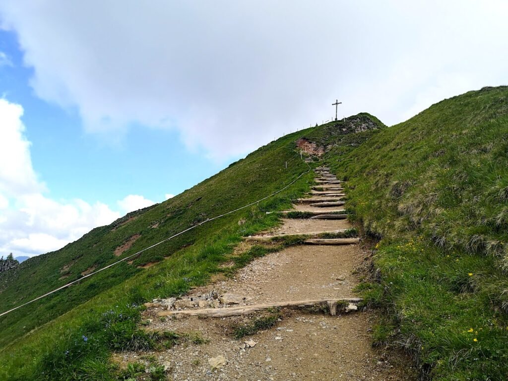
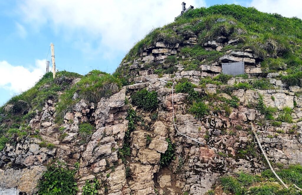
Reaching the top of the “steps” you’ll run in to the only climbing section of the route – sure-footedness here is a must.
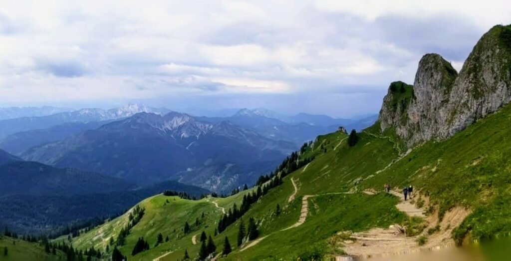
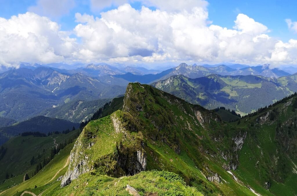
The Rotwand is the highest peak in the Spitzingsee region. Almost all the well-known peaks in the region, including the Wendelstein, Aiplspitz or the Brecherspitz, can be admired from the summit. In good weather, the view even extends to the striking peaks of Roßstein and Buchstein at Tegernsee with the Tegernseer Hütte, to the Zugspitze as well as the glaciers of the Central Alps to the south.
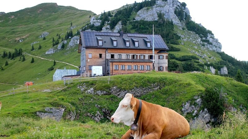
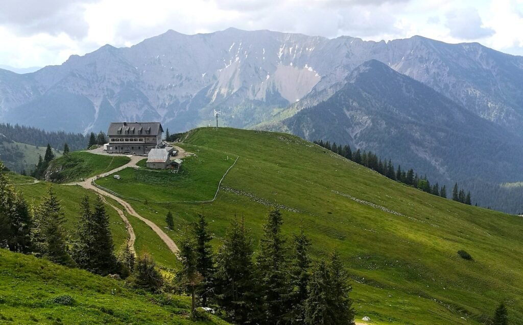
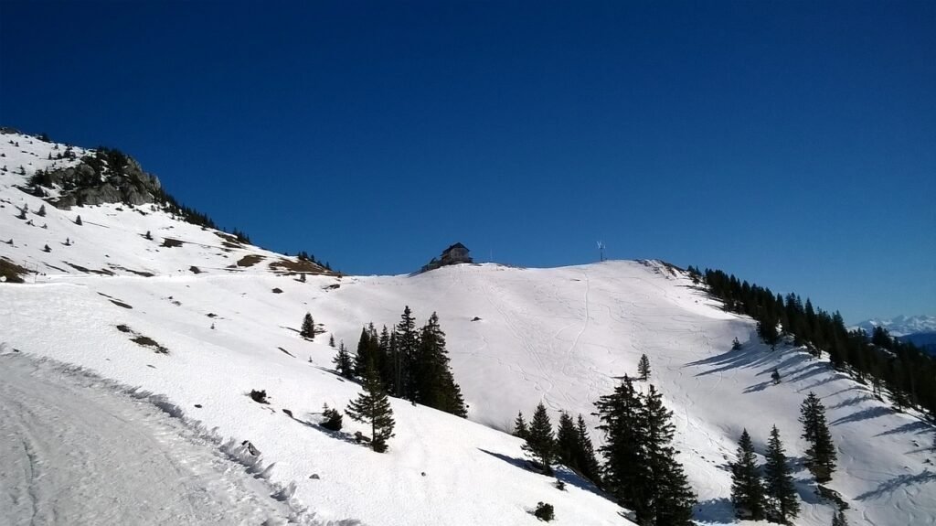
The Rotwand House
We recommend planning extra time for a break at the more than 100-year-old refuge of the German Alpine Association Rotwand House. The view across to the Bavarian Alps from the large sun terrace is too good to miss and the food’s not bad either
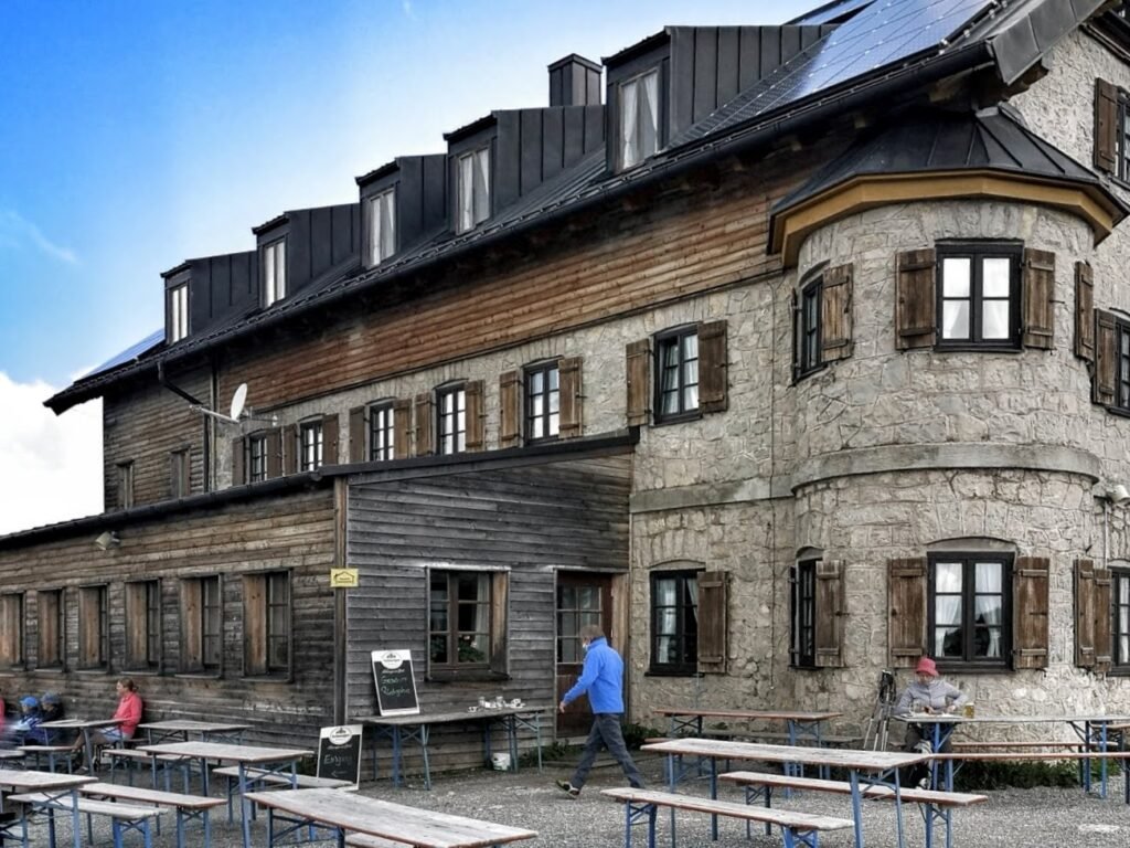
You can expect to find various seasonal, regional and Bavarian dishes on the menu. With a Knödel and a beer on board, the final stretch to the summit of the Rotwand should take around half an hour.
Descent from the Rotwand
The descent follows the same path as the ascent. Arriving back at Spitzingsee it’s worth considering a final walk along the Spitzingsee Loop Trail.
Alternative Route
The ascent described here is the most popular and easiest route for most hikers. There are however several alternative hiking trails that leading to the Rotwand here above Spitzingsee. Our personal favourite in the longer tour via the Pfanngraben. This route is quieter and and scenically particularly worth seeing. From the summit of the Rotwand is is possible to extend the hike up the nearby Hochmiesing.
Can I climb the Rotwand in winter?
The Rotwand is a fantastic choice for a winter hike near Munich. The path is usually prepared throughout the winter and is popular both for snowshoeing and sledging.
Trail Map
Parking
Those arriving by car will find ample parking along the shores of Spitzingsee. For those travelling by train: Take the Bayerische Regiobahn (BRB) from Munich to Schliersee and change to the RVO bus towards Spitzingsee, getting off at the Spitzingsee Kirche station.
Summary
The hike up the Rotwand is one of the most popular hiking tours south of Munich for good reason. The trail is manageable even for occasional hikers, the Rotwand House offers welcome refreshments before the final ascent to the summit and the summit itself offers one of the most beautiful views of the Bavarian Pre-Alp mountains.


